Political Belfast
Despite everything else, Belfast is probably best known for the Troubles. Since even Northern Ireland ‘experts’ seem to have problems explaining it, I won’t really try, but basically there are two groups: the Loyalists and the Nationalists. The Loyalists are loyal to the Queen of England and the Nationalists want to be part of the Republic of Ireland (the southern part). It happens that most of the Loyalists were Protestant and most of the Nationalists were Catholic so the Troubles have taken on a religious bent as well. It’s much more complicated that that, particularly as two rival protestant groups are currently fighting each other.
Keeping all that in mind, I decided to walk to North and West Belfast to see things for myself. (If you’re looking for murals, I’ve put them into a separate post, just to try and organize things.)
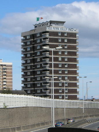
Walking to North Belfast, the first thing I noticed was that even the buildings made political statements.


The buildings have slogans along the top – the closest one says ‘Free Sean Kelly Now!’ and is flying the flag of the Republic of Ireland.
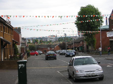
This street was also flying small orange, white, and green flags.

I also saw this building, the main Orange Lodge. It is here that the main Orange Order parades start during marching season.


The statue is of William of Orange and there is the flag of the United Kingdom and the Ulster flag.
I made it to Carlisle Circus on Crumlin Road and decided to head back. Evidently, this spot is an interface between Catholic and Protestant neighbourhoods. (And ‘interface’ is the term they use.)
The next day, I walked into West Belfast. (North and West Belfast are really not that far apart, just three of four blocks…it basically just depends on which main street you head down.)
Heading down Divis Street (which soon turns into Falls Road), I saw Divis Tower.

The top two floors (the 18th and 19th) and the roof are occupied by the British Army and used as a monitoring post. The week before my visit, the IRA formally renounced violence and the army started removing their equipment. At the height of the Troubles, however, the army was only able to access the post by helicopter.

This graffiti is fairly typical of that around West Belfast.

There are also memorials throughout the area.
Though there is construction going on, you can look between buildings and see parts of the ‘peace line,’ walls constructed by the army to separate the residents of Falls and Shankill Roads. More on walls later.

(The wall is between the trees.)
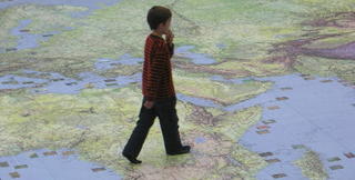
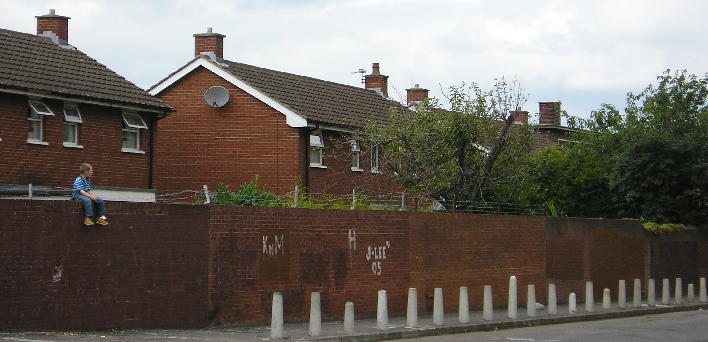
During my North Belfast walk and my West Belfast walk, I noticed a number of children playing in the streets. For some reason, children playing in the streets strikes me as particularly Irish (probably from seeing movies or things like that – maybe Angela’s Ashes, I don’t know). At one point, I turned a corner and saw this boy sitting on top of this wall.

He was just sitting there eating a sandwich. But look a bit closer.

Notice how tall the wall is? (Taller than my head, certainly.) Notice the barbed wire along the top?
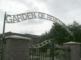
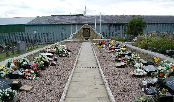
Further along is the Garden of Remembrance, with memorials to some of the Republican fighters killed during the troubles.

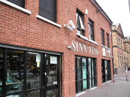
The Sinn Fein office is also on Falls Road.

There is a small gift shop attached (the doors to the left of the Sinn Fein words).

Continuing (far) along the road, eventually I arrived at Milltown Cemetery.

It is here that a number of Republicans are buried, including Bobby Sands, famous for his hunger strike.


One thing about Northern Ireland is its police vehicles.

Though I did see some ‘regular’ cars, these were much more common. Notice the tiny windows on the back portion and the metal mesh covering the lights. The windscreens have a metal screen that can be raised if needed.
A few words about the ‘peace line…’
Belfast has 26 walls that make up the peace line, put into place by the army over a number of years to keep the residents of Belfast from killing each other.

They started off like this one – just some metal fencing with razor wire on top. (Sorry about the poor photo – it was taken from inside the bus.) It’s probably about 8 or 10 feet tall.
Unfortunately, the situation necessitated the construction of taller, sturdier walls.

This wall is concrete, with metal and then wire mesh on top. You can see by the car driving by that it is a rather tall construction.


Some of the walls have murals painted on them as well as messages left by people from around the world.
Some streets also have electrically controlled gates that could be closed by the army if needed.
Keeping all that in mind, I decided to walk to North and West Belfast to see things for myself. (If you’re looking for murals, I’ve put them into a separate post, just to try and organize things.)
Walking to North Belfast, the first thing I noticed was that even the buildings made political statements.
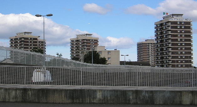
The buildings have slogans along the top – the closest one says ‘Free Sean Kelly Now!’ and is flying the flag of the Republic of Ireland.
This street was also flying small orange, white, and green flags.
I also saw this building, the main Orange Lodge. It is here that the main Orange Order parades start during marching season.


The statue is of William of Orange and there is the flag of the United Kingdom and the Ulster flag.
I made it to Carlisle Circus on Crumlin Road and decided to head back. Evidently, this spot is an interface between Catholic and Protestant neighbourhoods. (And ‘interface’ is the term they use.)
The next day, I walked into West Belfast. (North and West Belfast are really not that far apart, just three of four blocks…it basically just depends on which main street you head down.)
Heading down Divis Street (which soon turns into Falls Road), I saw Divis Tower.

The top two floors (the 18th and 19th) and the roof are occupied by the British Army and used as a monitoring post. The week before my visit, the IRA formally renounced violence and the army started removing their equipment. At the height of the Troubles, however, the army was only able to access the post by helicopter.

This graffiti is fairly typical of that around West Belfast.

There are also memorials throughout the area.
Though there is construction going on, you can look between buildings and see parts of the ‘peace line,’ walls constructed by the army to separate the residents of Falls and Shankill Roads. More on walls later.

(The wall is between the trees.)
During my North Belfast walk and my West Belfast walk, I noticed a number of children playing in the streets. For some reason, children playing in the streets strikes me as particularly Irish (probably from seeing movies or things like that – maybe Angela’s Ashes, I don’t know). At one point, I turned a corner and saw this boy sitting on top of this wall.

He was just sitting there eating a sandwich. But look a bit closer.
Notice how tall the wall is? (Taller than my head, certainly.) Notice the barbed wire along the top?
Further along is the Garden of Remembrance, with memorials to some of the Republican fighters killed during the troubles.


The Sinn Fein office is also on Falls Road.

There is a small gift shop attached (the doors to the left of the Sinn Fein words).
Continuing (far) along the road, eventually I arrived at Milltown Cemetery.
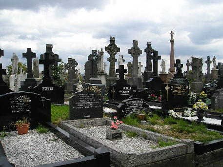
It is here that a number of Republicans are buried, including Bobby Sands, famous for his hunger strike.

One thing about Northern Ireland is its police vehicles.
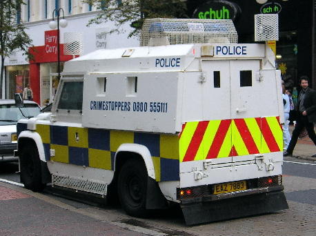
Though I did see some ‘regular’ cars, these were much more common. Notice the tiny windows on the back portion and the metal mesh covering the lights. The windscreens have a metal screen that can be raised if needed.
A few words about the ‘peace line…’
Belfast has 26 walls that make up the peace line, put into place by the army over a number of years to keep the residents of Belfast from killing each other.

They started off like this one – just some metal fencing with razor wire on top. (Sorry about the poor photo – it was taken from inside the bus.) It’s probably about 8 or 10 feet tall.
Unfortunately, the situation necessitated the construction of taller, sturdier walls.
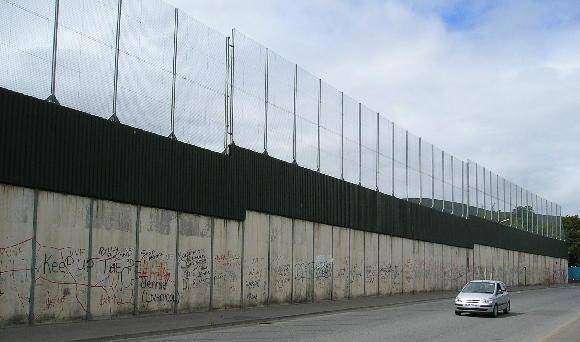
This wall is concrete, with metal and then wire mesh on top. You can see by the car driving by that it is a rather tall construction.
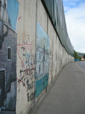
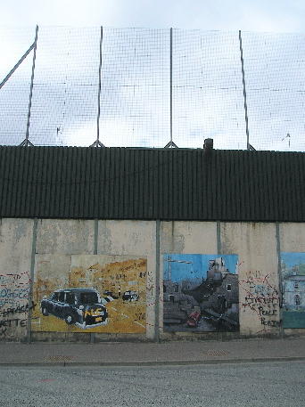

Some of the walls have murals painted on them as well as messages left by people from around the world.
Some streets also have electrically controlled gates that could be closed by the army if needed.
posted by Matthew Reames at 8/17/2005 11:36:00 AM
![]()
![]()


0 Comments:
Post a Comment
<< Home